| Day 20 (July 31st): LAS VEGAS, NM to MANITOU SPRINGS, CO | 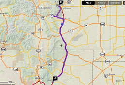 |
| <- PREVIOUS DAY | Predicted Dist. / Time: 320 mi. / 7:00 - Actual Dist. / Drive Time / Total Time: 351.5 mi. / 6:16 / 8:29 | NEXT DAY -> | |
|
Click n' Return:
|
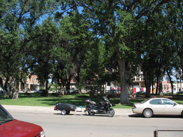
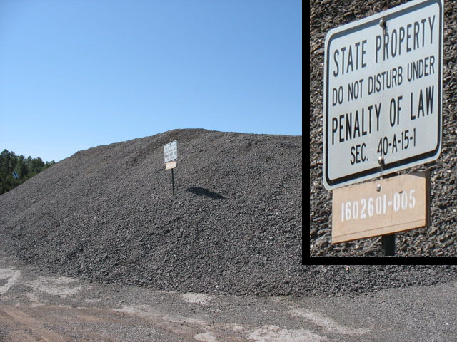
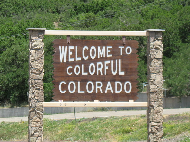
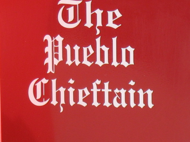
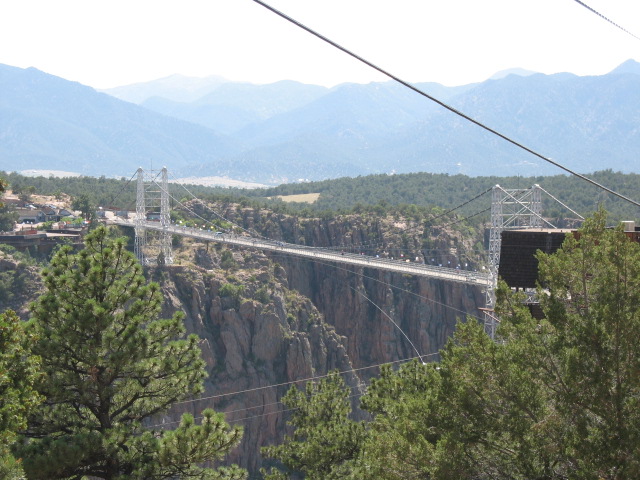
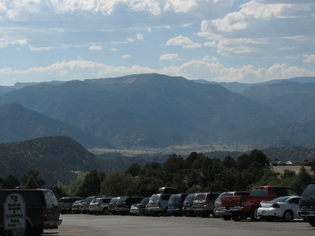
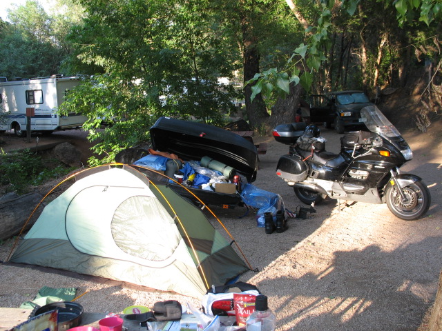
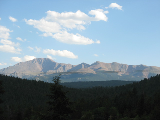
DAY TWENTY COMMENTARY Leaving Las Vegas (hey, that was a movie…though about the other Las Vegas -- Ed.), I executed a reasonably quick camp departure after having been out of practice for almost a week. I was worried about having to pay $4 for gas, since the nearest station also happened to be right off of the interstate. Turned out I needn’t have feared as it set me back just $3.949, and I cleaned the windshield, and I saw a guy who had to be at least 6’6” tall. People, that’s up there -- you just don’t often see folks that tall. I came across this oddity shortly thereafter. I punched my destination into the GPS and again caught something I failed to mention before: until it calculates an exact route, the unit first displays simply the straight-line distance to Point “B”. This didn’t make much of a difference in the case at hand, but if you’ll recall the Ozark Mountain Debacle back on Day Ten, it was first claiming I was only 50-odd miles away from to Eureka Springs while the actual drive around the mountains was more like 85+. Today threatened to be exceptionally boring for the first time in quite a while, as the second step of the directions was literally, “Drive 261.1 miles, then turn left onto Cimarron Road.” Z-z-z-z-z… Loafing along at peak torque in 5th gear, the ST1100 serenely ticked over the 4,000 mile mark for the trip just outside The Middle of Nowhere, NM. HEY! I’ve thoroughly enjoyed my time in the Land of Enchantment thus far, so we needn’t go dissing it. No, this milestone was reached just before a stupidly-executed construction zone near historic Fort Union, near Watrous. And there was also a male goat, which looked a lot like this guy, sitting there on a farm near the turn-off for Maxwell. WAITAMINNIT -- did that exit sign just say “Cimarron”, as in “Cimarron Rd.”, Manitou Springs? Did I just cover the 261.1 miles, but barely noticed it? NOPE! That sign was for “Cimarron, New Mexico”, Interstate-breath! Only 184 more miles to go! Z-z-z-z-z… Ho-hum -- even this Interstate here in NM was practically empty. As on a handful of long highway stretches earlier in the trip, I had the a few cars pass me by twice, their occupants obviously having stopped for lunch and/or gas and allowing me to get ahead of them during that time. The land was flatter now, though still at elevation I was certain, with some livestock grazing here and there. Well into the distance to the west, the plateau was bracketed by the Sangre de Cristo mountain range, and soon I was leaving New Mexico and crossing into Colorado. The first few seconds in Colorado were excellent, as coming around a turn the highway revealed a great view of what I am going to say were Little Bear Peak (elev. 14,037 ft.) and Mt. Lindsey (14,042 ft.) in the distance, although there was no place to pull over to snap a pic before they disappeared behind an embankment. The following few hours were about to turn pretty lousy, though, for a number of reasons. First, immediately after the view of the mountains was blocked, there was a sign for a “Scenic Overlook” less than a mile up the road. Although it looked like there’d have to be a fairly extreme turn in order for the road to offer that view again to northbound traffic, I figured they’d have designed it that way, and I’d get a second chance to photograph the first real tall peaks of the trip. Alas, as I eased to a stop in the parking area, I was disappointed to note that the peaks were still not visible. No, as I was to read in a few moments, the overlook was for an area in which there had once been a switchback railroad to take building equipment over a steep ridge, before the Raton Tunnel could be completed. A very big, very strong steam engine (nicknamed the "Uncle Dick") was developed, strong enough to pull 46 cars up the 6% grade -- in fact, it was so big and heavy that it had to be brought to the area in pieces and assembled on-site. OK, that was pretty interesting, I had to admit. But something else was interesting as well -- up ahead I noticed a pickup truck that had already participated in the “Pass The Chief (tm) Twice” competition, meaning that this was the third time I was seeing it. And yes, I’m sure it was the same one, because I remembered seeing the license plate. And what was interesting was that a guy had stepped out of the passenger seat of the $42,000 vehicle and began writing his name directly onto the historical marker about the railroad, and with a ball-point pen (?) I was flabbergasted. I mean, what the hell was this guy thinking? Yeah, I had also noticed that many people had written their names onto the guardrail between the asphalt and the drop-off, so perhaps that was the “thing to do” when you crossed the state line -- hey, it’s the guardrail, I guess I can let it slide if I really have to -- but this knucklehead was writing onto the marker itself, which meant that other idiots would soon see it as fair game, thus ruining it for everyone else. Thinking it might not be a great idea to bring it up with the jerk and the other two dopes in the truck, I waited until they left. And I called the Colorado State Police. The vandals were technically about half a mile “out of state” -- the pickup sporting New Mexico tags -- so I feigned indignation over this fact to sell the story to the dispatcher. Can’t say if they bothered tracking the guy down, but he did say they’d notify the highway department to go erase the graffiti. Colorado’s tax dollars at work, thanks to idiots. Traffic suddenly got a little busy, and the road quite a bit more crappy, after Trinidad and before Pueblo. As a side note, how many of you remember the public service ads for all of those government-issued pamphlets back during Saturday cartoons? You wrote to “Pueblo, CO” to get ‘em all! I was thinking of pulling in there and asking for the location of the likely empty shell of a building where all that used to go on…today, replaced by the “innernet”…and by apathy… Now, Pueblo was not exactly a small town, but seriously, what was up with all this traffic? Were there that many people only going between Trinidad and Pueblo, and in each direction to boot? As silly as that sounds, I’m serious, it really emptied out again after that. Maybe it was a huge pamphlet giveaway from back when Pluto was still a planet… no, wait, from earlier than that, like when eggs and meat were good for you, or bad for you, or good for you again, or, um…no, wait, from even earlier than that, like how to improve fuel economy now that gas was approaching $1 per gallon… Ah, the good ol’ days. So not only was the road suddenly crowded, the pavement was bad, and it was very hot. Annoyingly hot, because I wasn’t expecting it, though I should have remembered from my previous visit here that the hot plains air to the east gets stalled right here because it cannot make it over the wall of mountains just to the west. Usually this builds up enough that there’s a quick thunderstorm every afternoon, but that was still a few hours away so I wasn’t worried. It got hotter again as road work closed down the right lane and forced the now-clogged traffic to pass on the left. They were doing serious (and seriously overdue) re-paving operations, already having stripped the old stuff off, laying down the new stuff, and literally baking it down by applying incredible heat to each section from below a trailer-type apparatus. A downward-pointing oven on wheels, no better way to describe it. You could see occasional flames and smoke underneath the baking rig, so how much fun do you think it was for me to ride past it at 15 MPH? Got your answers? Good. Now do you think it became more fun, or became less fun, when the old pickup truck directly in front of me stalled out and would not re-start, right as we were directly alongside one of the wheeled ovens? This, with no room for me to pass around on the left (as the shoulder of the narrow left lane dropped off precipitously) and having no desire to get any closer to the mobile inferno on the right? Cannot make this stuff up. It took fully three minutes for a DOT truck to maneuver its way through the construction equipment from the other direction, hook up a chain, and pull the truck to the nearest spot with room to move it over. Now, that doesn’t sound very long -- and, in fact, they got the hook-up done in no more than about twenty seconds -- but think about sitting next to that heat, and that tar smell, and that smoke, while wearing jeans and a jacket and a helmet and gloves, for one hundred and eighty seconds. And true, the poor bastards on the work crew have to deal with that every day, but then “poor” is likely not the most accurate term, as they pull down $40 an hour to deal with it. Not only was The Chief (tm) not getting paid, but he was worrying about the bike, sitting still for minutes at a time in 90-degree heat, sucking all that hot air into the system with just its tiny little fan to cool it off. Aah, but it’s a fourteen year-old Honda, so it was fine. A Harley in the same situation breaks down in thirty seconds. Finally moving again, and rider and bike both able to breathe, I passed the turn-off for Ludlow and a sign for the Ludlow Massacre Monument. I continued north, with the plan to branch off to the northwest before Denver to visit the Royal Gorge Bridge, which passes some 1,300 feet above the canyon below. Lemme tell ya something -- this time, it was good that I followed the GPS’ directions to Canon City, the nearest town (more truthfully, I hadn’t actually brought along the original directions I was going to use, which would have crossed the bridge from west to east, but why don’t we let the GPS have this one anyway). OK, Rte. 50 west to get there was really annoying, with -- here we go again -- traffic, construction, stupid driving, etc., although I had seen a welcome notice. But what was still good about it? Well, because the bridge does not carry an actual road, which would otherwise have been Rte. 35. No, it’s merely a point of interest, a tourist attraction! Yes, it’s pretty, but it’s also really bogus; $24 for an adult to get in and walk across, all because there are stupid rides and other garbage in there? Are you kidding me? The bridge and the view I wanted to see; might have paid $10 for it. Who needs the other junk? So, considering that I: 1) had fortunately planned to ride an official Scenic Byway originating nearby anyway; 2) fortunately hadn’t approached it from the west, which would have required some significant backtracking; 3) knew for certain that I was going to see similar such wonderful views for the next week or so, free of charge; and 4) snagged two excellent, detailed Colorado maps gratis, I passed on this one. Leaving Canon City -- but not before seeing this rest stop -- I turned my attention to finding the start of High Park Road, one of the three Gold Belt Scenic Byways I wished to take. One of the other two was a dirt road for its entire length, and the other was graded gravel, but very twisty and steep, and not recommended for a trailers -- a combination the Pork Chop Express didn’t necessarily need to tackle. I found it and got underway on the last fifty miles to my destination. The scenery was very nice, with bigger peaks off in the distance, rolling hills with farmland and small lakes tucked in here and there, etc. But I was still pretty annoyed at my over-the-road experience in Colorado thus far, the road surface here was rather abrasive, and my rear end was getting a bit sick of it all, so I wasn’t in the most appreciative of moods. It didn’t improve when I noticed a slight shimmy coming from the handlebars at stoplight speeds, which upset balance and made medium-speed turn-in a bit less precise on these curvy roads. Will have to keep an eye on it, maybe visit the next Honda dealership I happen to see… The town of Manitou Springs was very cute, and as tempting as it was I did not go out that night because I needed to be ready for a quick departure in the morning. To this end I used the small tent, the Eureka "Backcountry Bivy", for first time on the trip. I hoped that its likely quicker tear-down would help me to successfully make my 8 AM reservation on the cog railway to the top of Pikes Peak! The campground was nice, and I did some laundry and worked on web updates, although neither water nor electricity was provided right at the campsite as I had thought they would be. I hit the sack “early” -- at midnight! |
|
|
|
|
|||