| Day 18 (July 29th): PECOS, TX to ALAMOGORDO, NM | 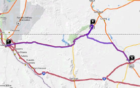 |
| <- PREVIOUS DAY | Predicted Dist. / Time: 263 mi. / 5:00 - Actual Dist. / Drive Time / Total Time: 316 mi. / 5:57 / 7:03 | NEXT DAY -> | |
|
Click n' Return:
|
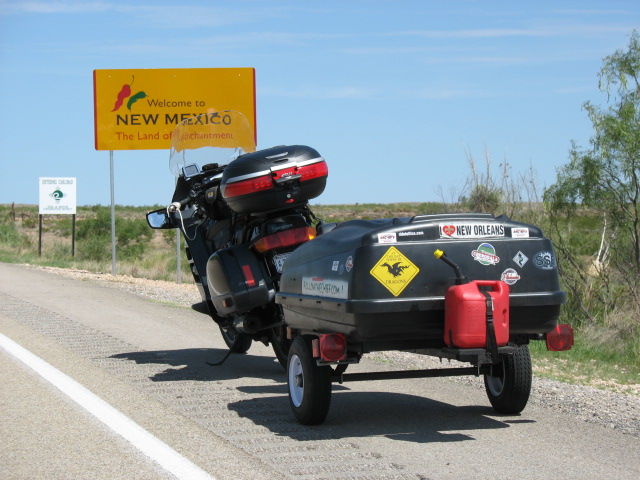
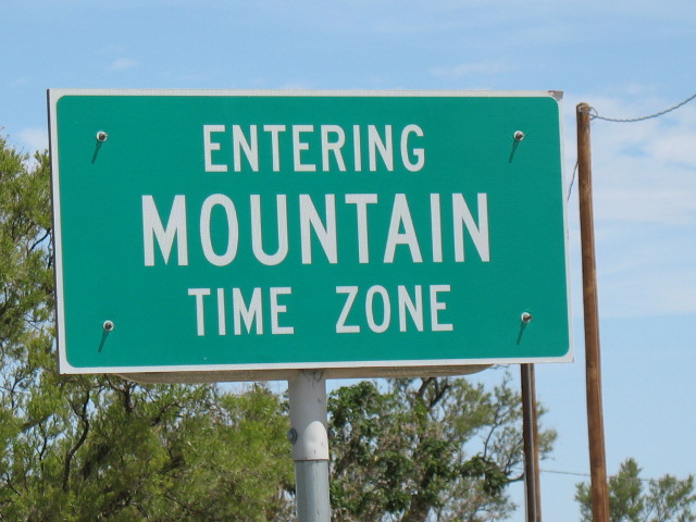
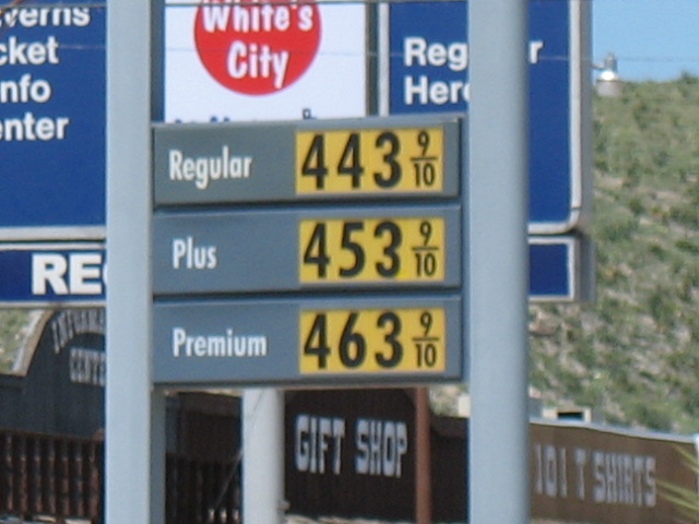
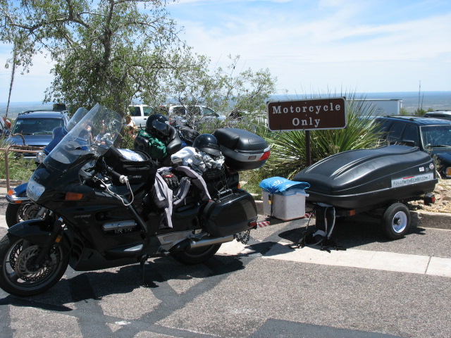
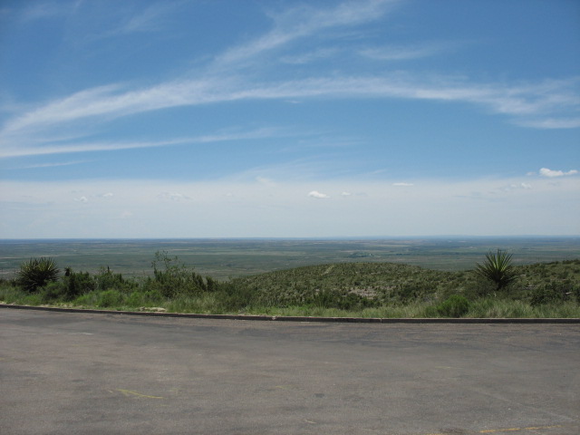
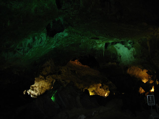
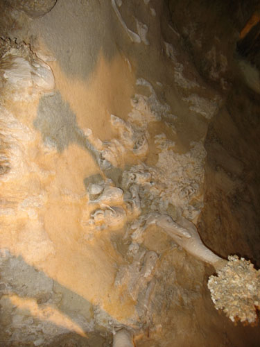
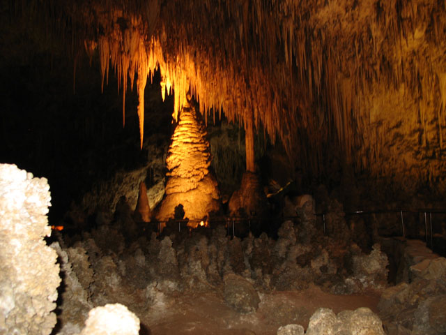
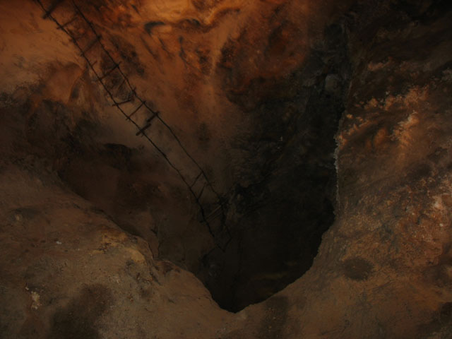
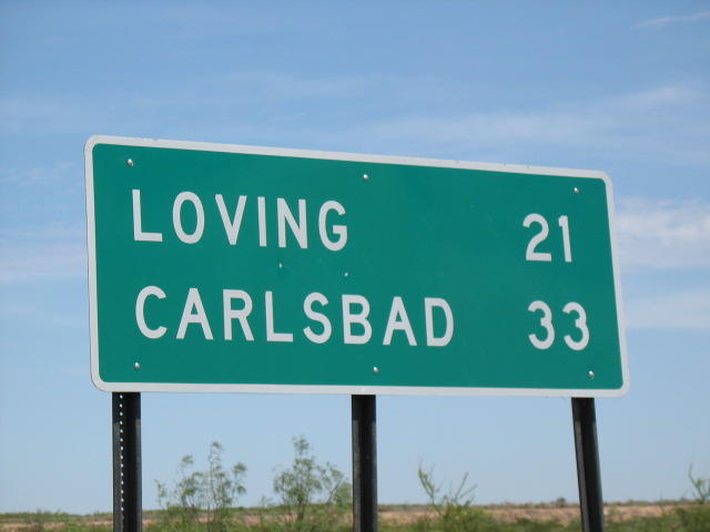
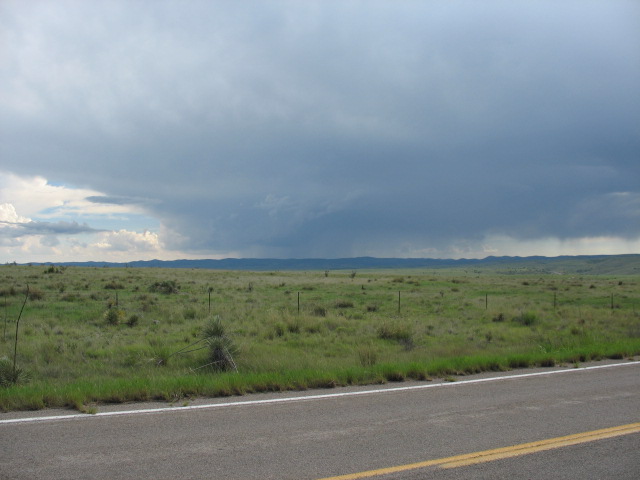
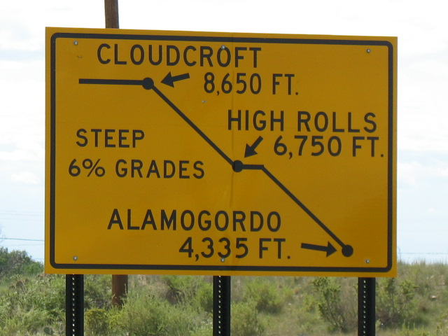
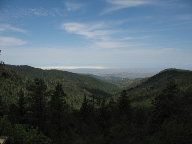
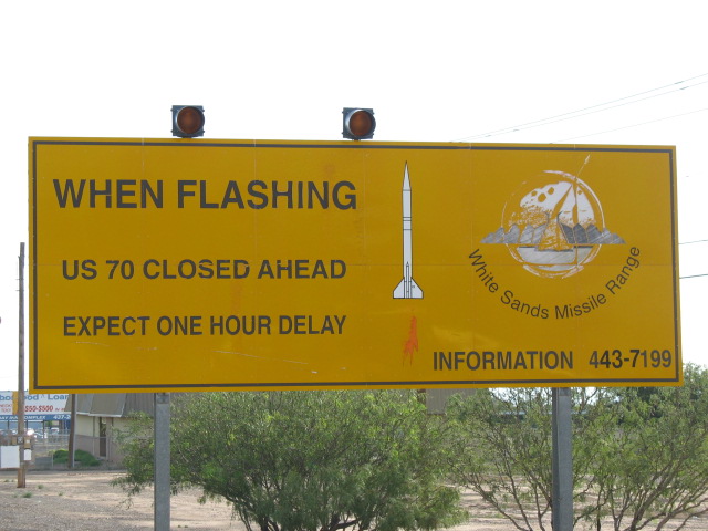
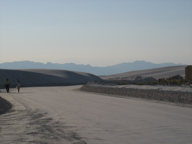
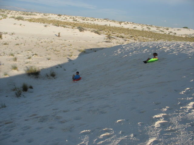
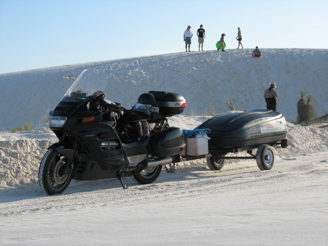
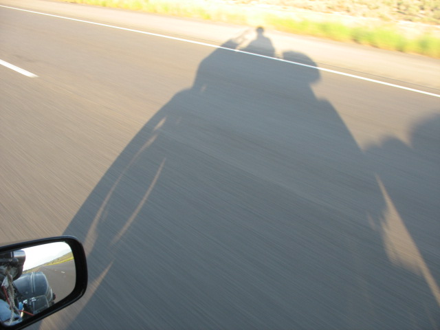
DAY EIGHTEEN COMMENTARY AUDIBLE! That’s right, The Chief (tm) called his first major audible today! Funny thing is, it left him struggling to determine whether or not the move bought him an “extra” day on the trip. After much consideration, the fact is that it did not, although it may open up some new route opportunities heretofore impossible to consider (and it definitely renders the map above inaccurate). Before we get to that, I know what you’re all thinking; “Did the New Way help you leave the hotel more quickly this morning?” And I am thrilled to report that the answer is a resounding “YES”. The bike was fired up for liftoff just about ninety minutes after the moment I rolled out of bed, and while that may not sound terribly quick, it definitely represents an improvement over the 2+ hour ordeals of several recent mornings (this also, if I may pat myself on the back, included a morning workout that featured an unheard of 121 pushups in the first round). Altogether this allowed me to begin the “gas station ordeal” quite a bit earlier than usual. I pointed the Pork Chop Express back in the same direction I came in on the main drag, Rte. 285, passing Alfredo’s from the night before and then the center of town. Once through the center of town, though, that’s it: you are out of town. All the dwellings and buildings are gone and the landscape returns to somewhat flatter hills than before, still dominated for miles around by gigantic ranches and the occasional oil rig, and what I believe are the Davis Mountains (elevations into the low-6,000 ft. range) bracketing the western horizon off in the distance. I didn’t see too many motorcycles – OK, none – but I did see the first Smart Car of the trip. Did you know that this vehicle is the same length as the Honda ST1100 (even before you add a trailer to it)? Anyway, I wonder what the driver thought of a particular stretch of road that went dead straight for thirteen miles. And eventually, I left Texas and entered New Mexico, passing into the Mountain Time Zone by heading directly north! And this time zone change was to come in handy later on, just like the last one into Alabama and the Central zone… "So what’s all this about an audible?", it would be fair to ax. Well, the original plan for today was to take the same route I was currently on, visit Carlsbad Caverns National Park to the southwest of Carlsbad, NM, then head west and overnight in El Paso, TX. The following day was to feature a swing back to New Mexico to visit the White Sands National Monument, finishing up by heading well north of Alamogordo for the evening. Looking at a map and thinking it over, I decided that since I hadn’t really locked anything down in El Paso, why not try to hit both Carlsbad and White Sands in one day, and stay in Alamogordo that evening? It would demand a quicker and therefore earlier than usual departure, but the New Way had already gotten us off to a good start, so I went for it. The New Mexico stretch of Rte. 285 was similar to the Texas side, even continuing the practice of putting occasional picnic sites along the side of the road; sometimes in scenic spots, sometimes not, but it looked like they did see use from time to time. The nearby hills seemed slightly flatter than in Texas, although the elevation was already into the low-4,000 ft. range, and now the Guadalupe Mountains loomed large off to the west. Eventually I was directed to cut west using County Road 720, which passed directly across a currently-dry riverbed, though a sign suggested to “Watch For Water”, and other signs weren’t so well-received. Nearing the Caverns, I approached the hamlet of White’s City, which had recently been in the news as its owners – a fourth-generation family of landlords – had attempted to sell the entire fading town. I hadn’t seen how the auction turned out, but I had been struck by the series of old, old advertisements along the road; one hawking “Kodak Film and Flashbulbs”, and the spindly, worn-out shape of all of them reminding me of the totems guarding the “Forbidden Zone” in the original “Planet of the Apes” film. Passing on the chance to overpay for gas here – and that is to put it mildly – I climbed the park road to the peak underneath which the Caverns are found, and docked the rig in the “Motorcycle Only” section right near the entrance. The visitor center looks high out over the broad plain below, and while the elevator to the main cavern drops some 750 feet, its riders are technically still thousands of feet above sea level. A mere $6 brought me to the gateway to “The Big Room”, the main walking area for non-guided tours. Those with claustrophobia need not worry about any such fears here – this “room” occupies some 60,000 square feet, or almost 114 football fields, and features a “ceiling” that is 140 ft. high in certain places. There were all the countless different and beautiful limestone formations one would expect, to go along with the sheer size of the open area. One spot still had a rope ladder leading down into a chasm, hinting at the efforts of the early explorers of the cave, and another still deeper hole was called “The Bottomless Pit”, as given the lighting equipment those hardy souls had to use, it probably did seem bottomless. It is said that much of those lower sections has yet to be fully explored or mapped. I know that I couldn't get the camera to take a useable picture of it... :-( I was not thrilled about walking out of the nice, cool air down in the cave and back in to the hot, sunny air, even at the peak, although I was able to score the first bumper sticker for the trailer in quite a while. The plan now was to head north through the town of Carlsbad and then west to Alamogordo for White Sands. Carlsbad proper was mightily annoying, as I believe I missed every possible streetlight in the high-’90’s temperatures – hence the moniker ”Sun Country” for the area -- not to mention that the road was somehow rutted and pot-holed. Leaving there, the next town at which I turned west, Artesia, was much more attractive in a still-rebounding way, with some interesting architecture (the Land of Sun theatre) and downtown historical displays. Next up came Hope, NM (not Hope, AR, you’ll recall as the birthplace of Bill Clinton), which mainly consisted of two general stores and – I am not making this up – a volunteer fire department that looked like it had been, um, burned down. The road headed west and opened up, and there were very few other vehicles to be seen. Eventually it began to weave and dip, and headed towards storm clouds near the start of some hills. Entering the Lincoln National Forest in Otero County, I travelled alongside the Penasco River, small but gushing because it was obvious that yet another downpour had occurred here moments before the arrival of The Chief (tm). The air was still so cool that I pulled over to remove the mesh jacket and don the leather. The archetypical little two-block town of Mayhill was highlighted by a “hotel”, a bar & grill, a church and gas station. Later I learned that this area was called Cloud Country, and they weren’t kidding, as the weather patterns tended to stall the clouds right above this 8,800 ft. plateau. The road passed through another awesome little frontier-ish town called Cloudcroft, just as it was about to plunge almost one mile down into the Tularosa Basin formed millions of years ago, now the location of Alamogordo. Vistas were incredible, though difficult to capture on camera thanks to the 10% downhill grade and twisty road, which passed through what I am told is the only highway tunnel in the entire state! (Imagine when they had to order signs for the tunnel? SAMPLE CONVERSATION: Rookie Salesman: “Hello, Joe’s Signs, how can I help you?” State of NM: “Yeah, state of New Mexico here. We need new signs for every tunnel in the state.” Rookie (dollar signs flashing): “Excellent, sir! We can get right on that. How many would you need?” State of NM: “Two.”) The White Sands were visible south of the city in the distance through the gaps in the cliffs, shining brightly in the setting afternoon sun. Here is where the Mountain Zone time change saved the bacon yet again, as I had essentially gained an hour during my travel, and so there was still time to visit the park. Passing through Alamogordo wasn’t terribly thrilling -- aside from the magnificent views of the mountains that I had just descended from, sadly not captured well on camera. Signs like this and the presence of Holloman Air Force Base, home of the fleet of F-22 Raptor fighter planes, also spiced things up a bit. These planes were seen landing, though barely heard in advance, and electronic billboards scrolled through messages such as, “2-liter Coke, $1.29 with card…welcome home F-22 personnel and crews…” While my pictures fail to reflect it, White Sands was striking in its quiet beauty -- and also fun to see what the kids do with it -- and the story of the fields’ formation and ongoing advance across the basin floor was of great interest. A walking tour was about to begin, but thanks to my Audible, I hadn’t yet secured lodging for the night and therefore had to pass. Not before almost dumping the bike over in a sand parking lot while snapping a few pictures, that is. Having headed back into town, I grabbed a room at the Motel 6 (good prices, decent rooms, usually a pool though no breakfast like the slightly higher-priced Days Inns) and implemented the New Way again (though I walked to a nearby joint for dinner, a national chain that I care not to admit patronizing although the food was fine). There I met a fellow long-distance motorcyclist over a few 22-oz. Bud Lights, priced at just $3 for Happy Hour, so as you might guess no web pages were updated at all. Good night! |
|
|
|
|
|||